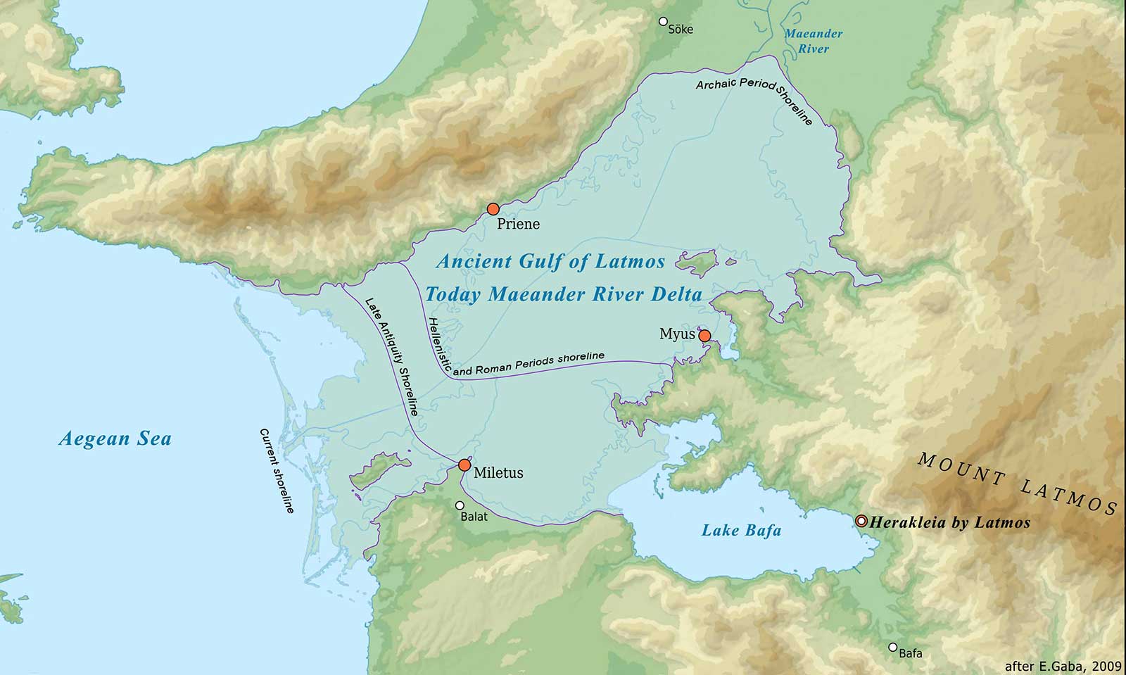
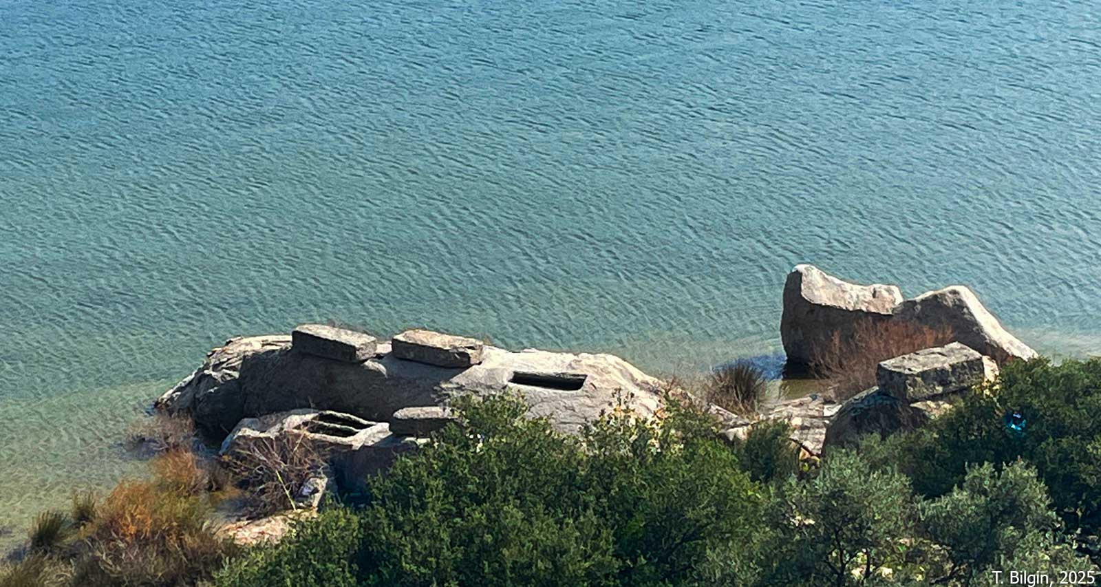
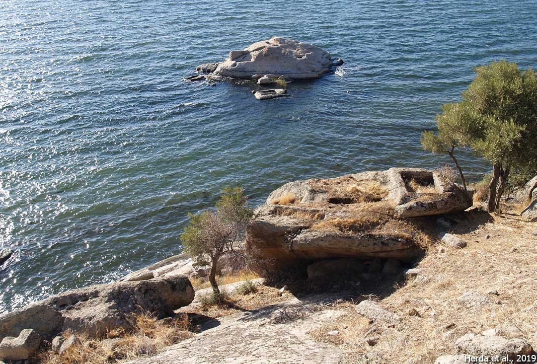
The settlements of Latmos and Heracleia represent a unique dual-site archaeological landscape, illustrating the transition from an indigenous Carian “withdrawal settlement” to a Hellenistic polis. Both cities are situated on the southern slopes of Latmos Mountains (modern Beşparmak Mountains) bordering the former Latmian Gulf (modern Lake Bafa), a marine inlet that extended inland from the Aegean in ancient times. Due to the progradation of the Maeander (Büyük Menderes) River delta, the marine gulf was gradually cut off from the sea, transforming into the brackish Lake Bafa. While marine conditions persisted into the Hellenistic period, sedimentation rates increased significantly in the Roman era, eventually landlocking the harbors.
Latmos represents the indigenous Carian settlement phase, occupied prior to the Hellenistic period. Described as a withdrawal settlement, Latmos is concealed within the rocky terrain, roughly 1 km inland from the coast. The city is characterized by rock-cut architecture; houses were often built directly into the gneiss bedrock, making them nearly invisible from a distance. The settlement included fortifications, a “palace,” and an agora. Over 200 simple rock-cut graves are located within the city limits, sometimes adjacent to houses.
Heracleia was established in the late 4th century BCE as a new foundation to replace Latmos, located directly on the coast, approximately 10–15 minutes by foot from the old city. The city is often referred to as Heracleia under/at Latmos to distinguish it from its namesakes. While some theories attribute the foundation to the Hecatomnid dynasty (e.g., Mausolus), the prevailing view links it to the Macedonian commander Pleistarchos, under whom the city was briefly named Pleistarcheia before becoming Heracleia.
The shift from Latmos to Heracleia was not merely a relocation but a political restructuring. A synoikism (political consolidation) contract united Latmos with the neighboring Carian settlement of Pidasa, likely to boost the population of the new city. The old city of Latmos was largely dismantled to provide building materials for Heracleia, essentially erasing the old settlement to force the population to move.
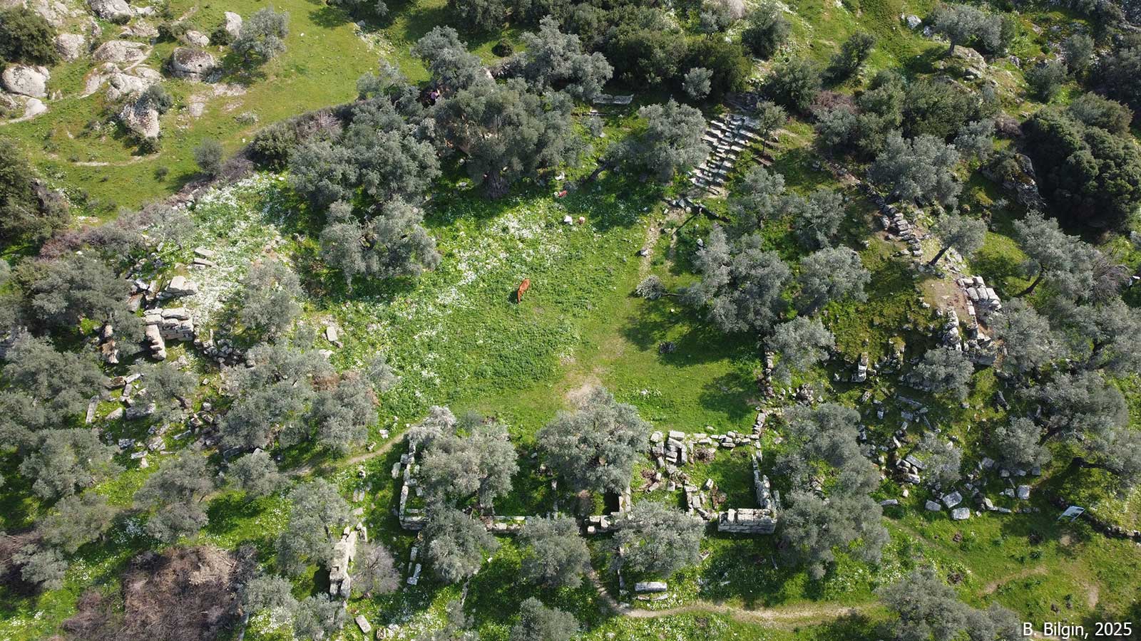
During the Hellenistic period, the city changed hands several times between the Ptolemies and the Seleucids, and regained its independence after the Romans defeated Antiochus III in 188 BCE. Many monumental structures, such as the theater, agora, bouleuterion, and gymnasium, were built during this period when the city experienced its period of prosperity. In 129 BCE, with Caria becoming part of the Roman province of Asia, Heracleia lost its independence. Because it underwent very little development during the Roman and Byzantine periods, Heracleia retained its Hellenistic form. Known to have been a bishopric during the Byzantine period, the city was abandoned from the 14th century onwards.
Richard Chandler, who first visited and recorded the city in 1764-65, identified it as Myus. This identification error was corrected by Choiseul-Gouffier in 1782. The first scientific studies in the region were initiated by Theodor Wiegand in 1905. Extensive surface surveys, started by A. Peschlow-Bindokat in 1974 and continued intermittently until 2009. The first systematic excavation work was started by Zeliha Gider-Büyüközer in 2021.
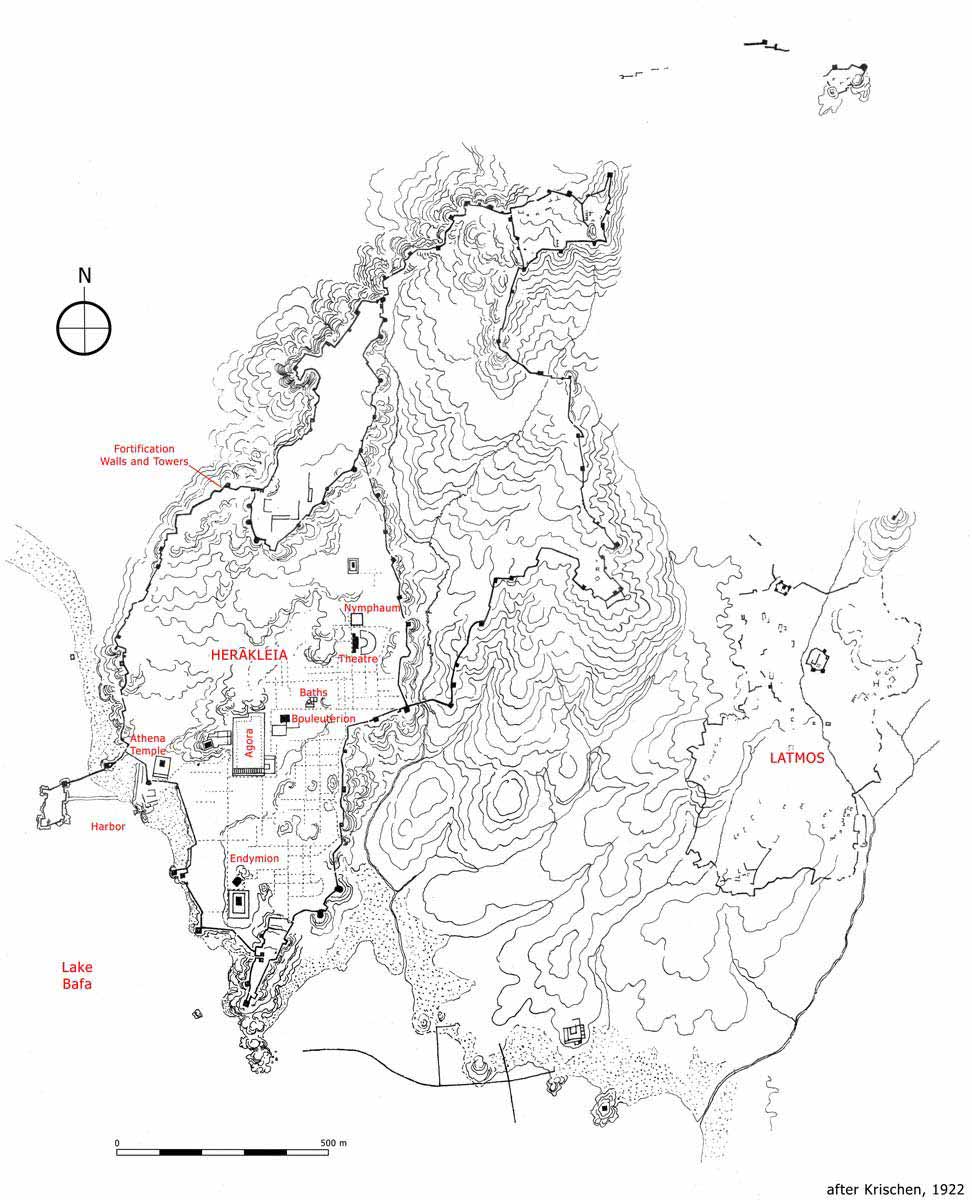
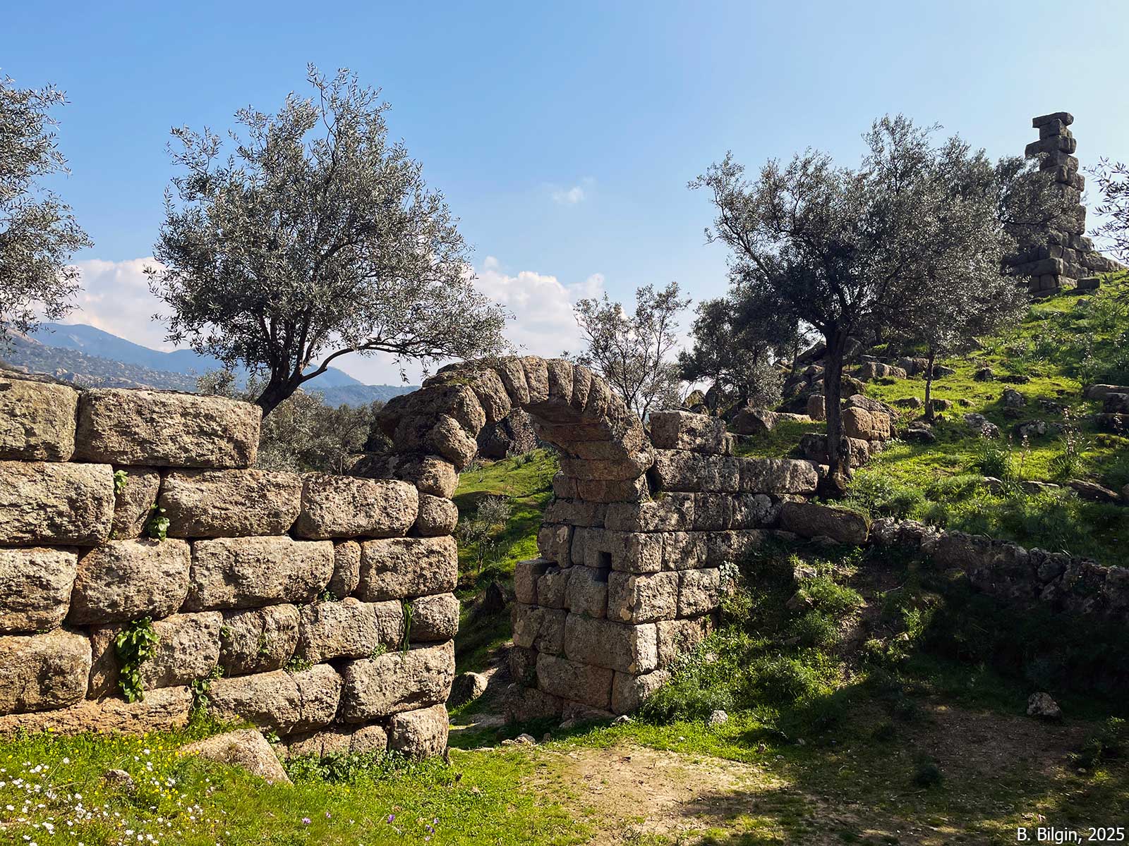
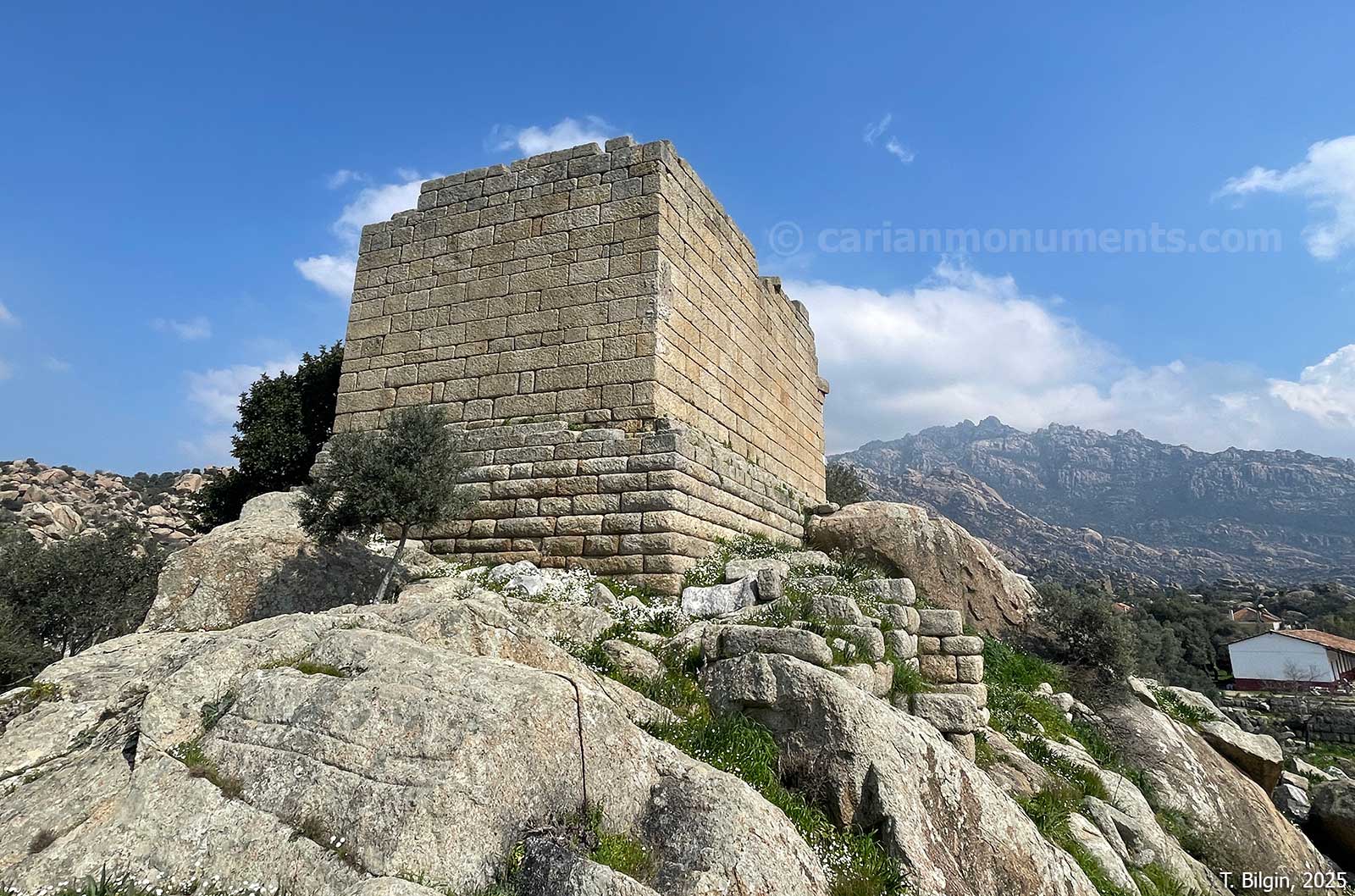
The Hellenistic city of Heracleia under Latmos is defined by its spectacular and well-preserved fortification system, which stretches 6.5 km and includes 65 towers, enclosing a rugged terrain organized by a Hippodamian grid plan. Dominating the urban landscape is the Temple of Athena Latmia, a Doric temple located on a rocky promontory and uniquely oriented toward the summit of Mount Latmos rather than the street grid. The city’s commercial center, the agora, features a massive two-story market building with magazines on its southern side and is flanked by a bouleuterion at its northeast corner. Other notable monuments include a theater, a Roman bath complex, and the so-called Sanctuary of Endymion, an apsidal building cut into the rock that mimics a natural cave to honor the city’s mythical founder. The settlement is further characterized by an extensive necropolis of rock-cut graves scattered throughout the city, often situated in immediate proximity to residential areas.




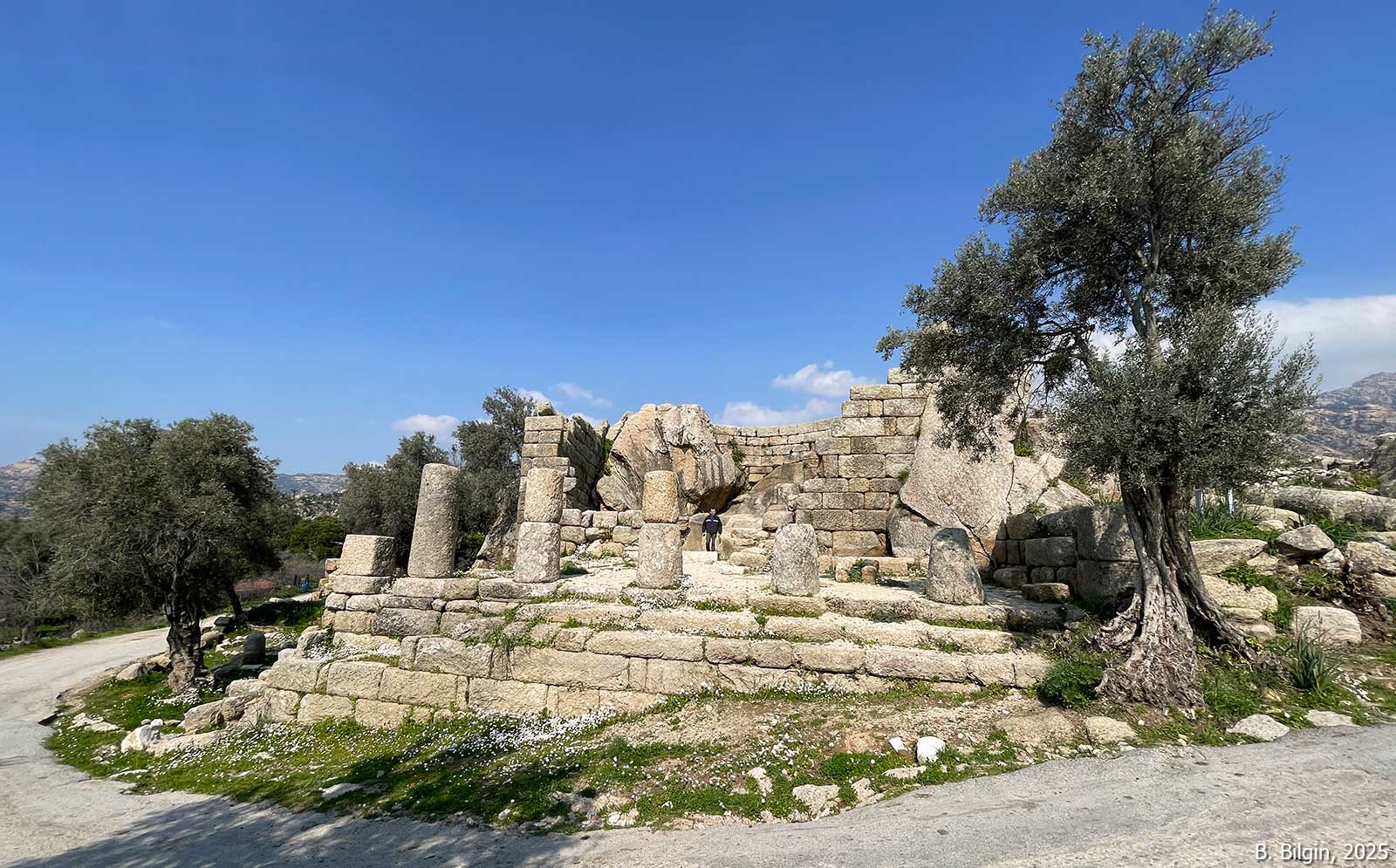
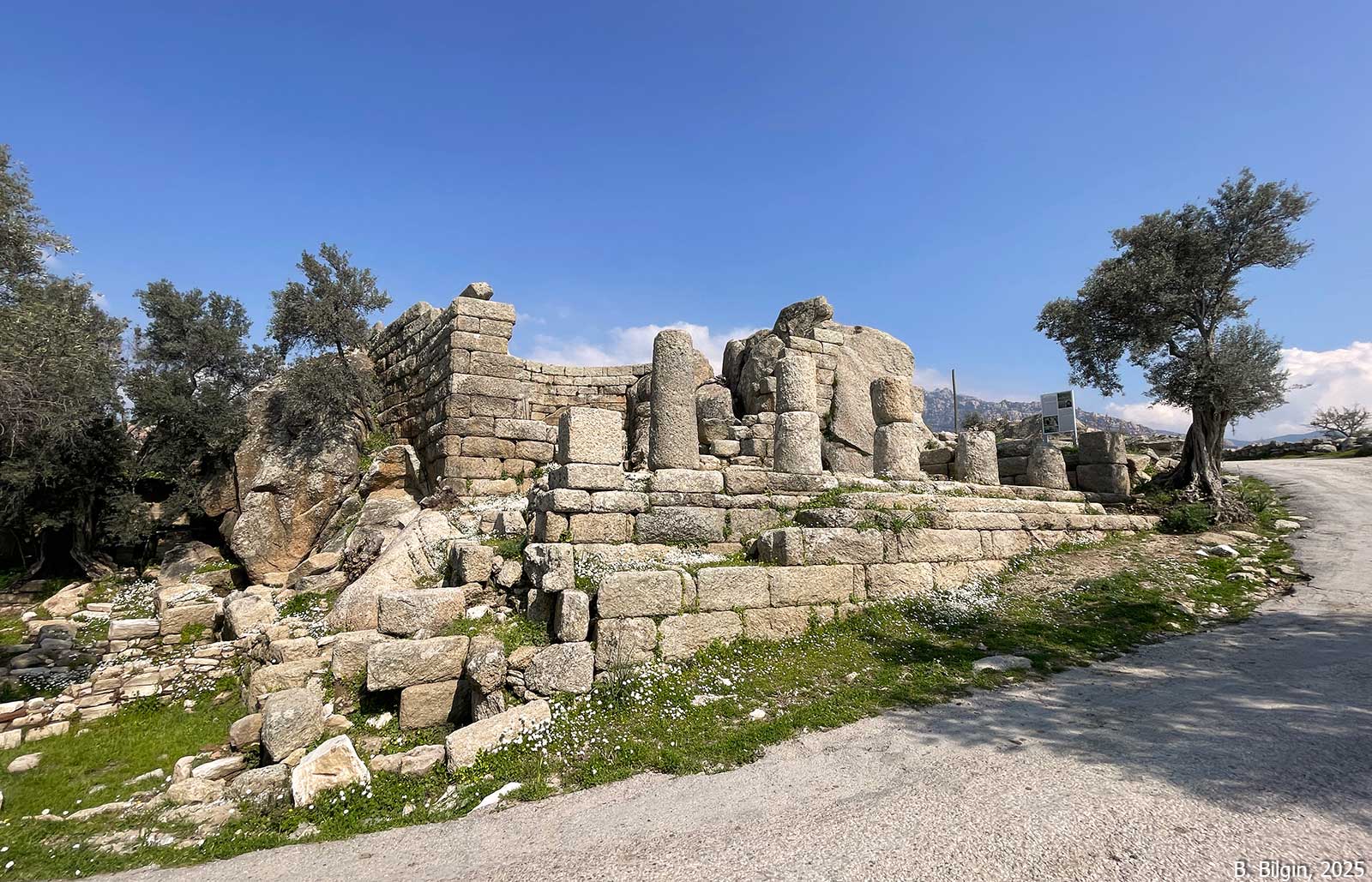
Temple of Athena Latmia
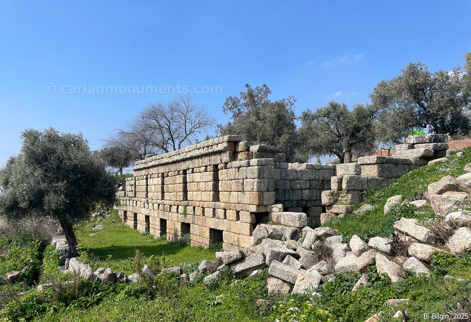
It is a Doric temple in antis located on a rocky prominence, oriented toward the peak of Mt. Latmos rather than the sea or the city. The peak of Latmos was a sacred site for a weather/rain god from prehistoric times through the Byzantine era (as St. Paul of Latros). The primary deity of Heracleia was Athena Latmia. Her epithet and the orientation of her temple suggest she is a Hellenized version of an indigenous Anatolian mountain goddess, possibly “Thea Akra.”

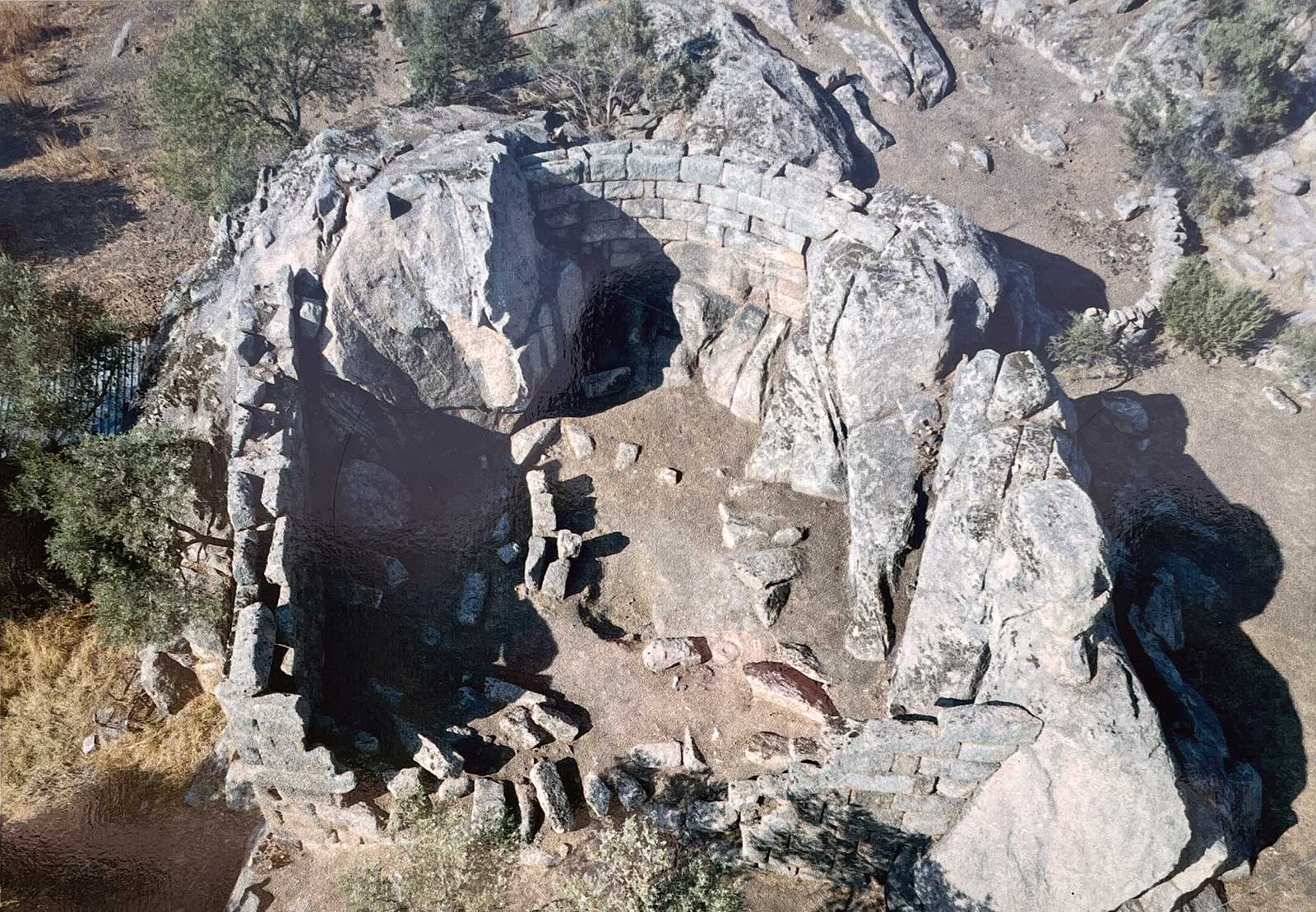
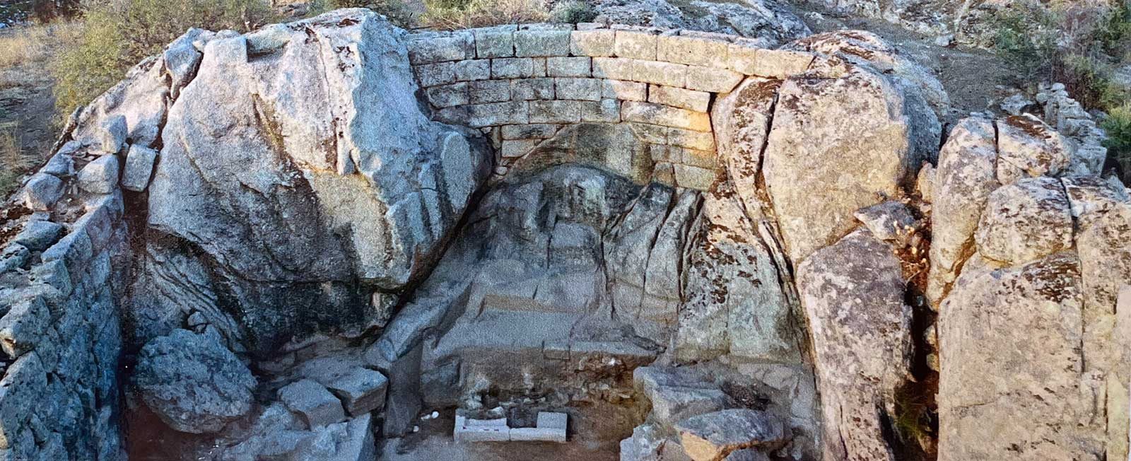
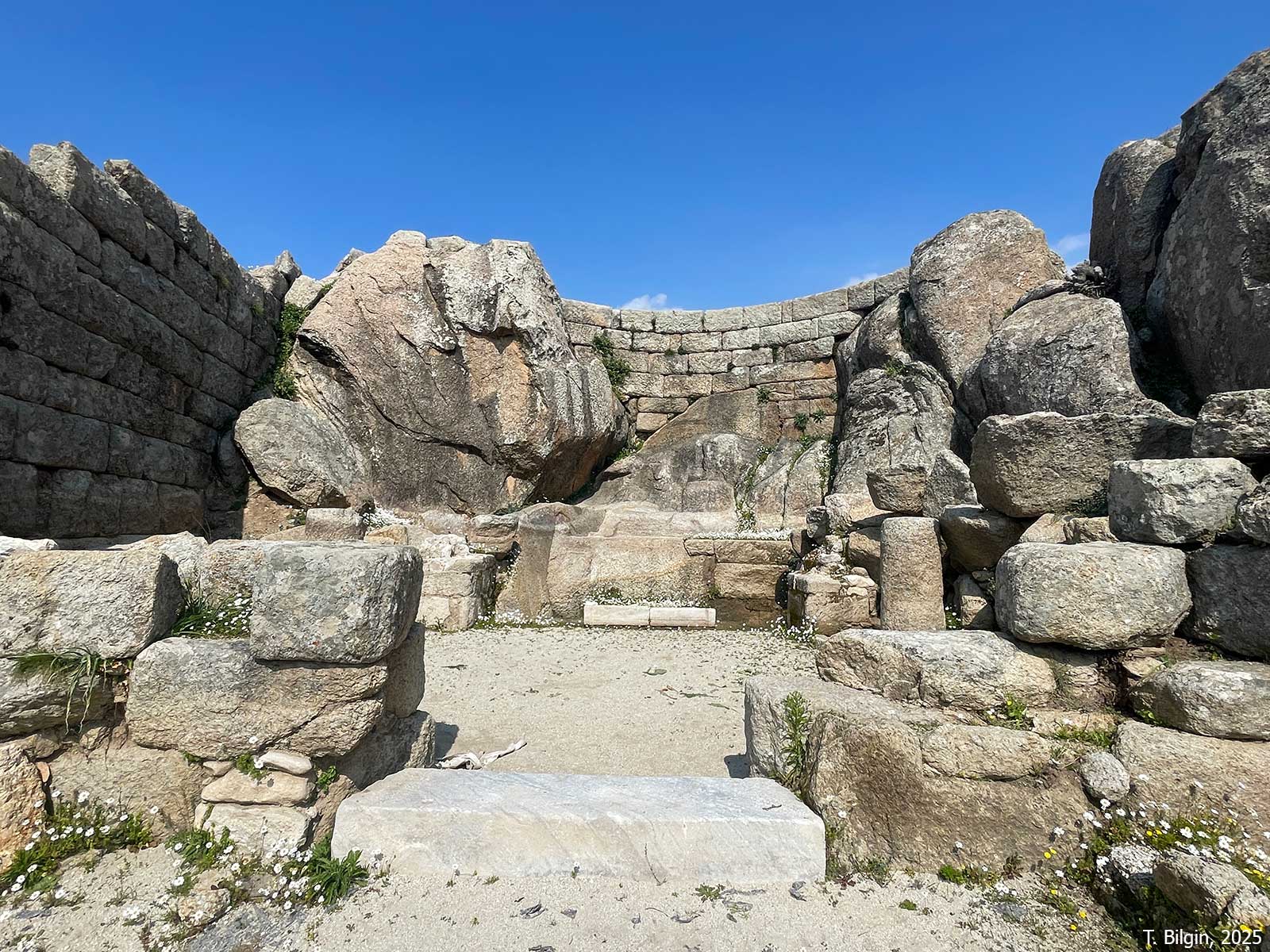
Sanctuary of Endymion
The shepherd/hunter Endymion is the central mythical figure. While Greek tradition (via Elis) claims his tomb is in Olympia, local Heracleian tradition holds that he sleeps eternally in a cave on Mt. Latmos. This myth likely represents a Greek adaptation of a local Carian mountain deity. An apsidal building cut into the rock, believed to be a shrine to the mythical founder Endymion.
References:
Akkurnaz, S. 2018. “Latmos ve Herakleia Yerleşimleri,” in Bir Dünya Kültür Mirası Latmos, eds. E. Akdeniz & S. Akkurnaz, İstanbul, 8–41.
Herda, A. et al. 2019. “From the Gulf of Latmos to Lake Bafa: On the History, Geoarchaeology, and Palynology of the Lower Maeander Valley at the Foot of the Latmos Mountains,” Hesperia 88/1, 1–86.
Krischen, F. 1922. Die Befestigungen von Herakleia am Latmos (Milet 3.2), Berlin.
Opitz, K. 2017. “Two Cities – One Goddess? The Transfer of Ancient Cities in the Hellenistic Period and the Reinterpretation of Older Cults: The Example of Heracleia under Latmus,” in Cityscapes and Monuments of Western Asia Minor: Memories and Identities, eds. E. Mortensen & B. Poulsen, Oxford, 187–204.
Peschlow-Bindokat, A. 2005. Herakleia am Latmos: Stadt und Umgebung, İstanbul.
Posamentir, R. 2020. “Heracleia under Latmus,” in The Carians, From Seafarers to City Builders, eds. O. J. Henry & A. Belgin-Henry, İstanbul, pp. 446–465.
Images:
F. Krischen, 1922
Eric Gaba, 2009
Bora Bilgin, 2025
Tayfun Bilgin, 2025