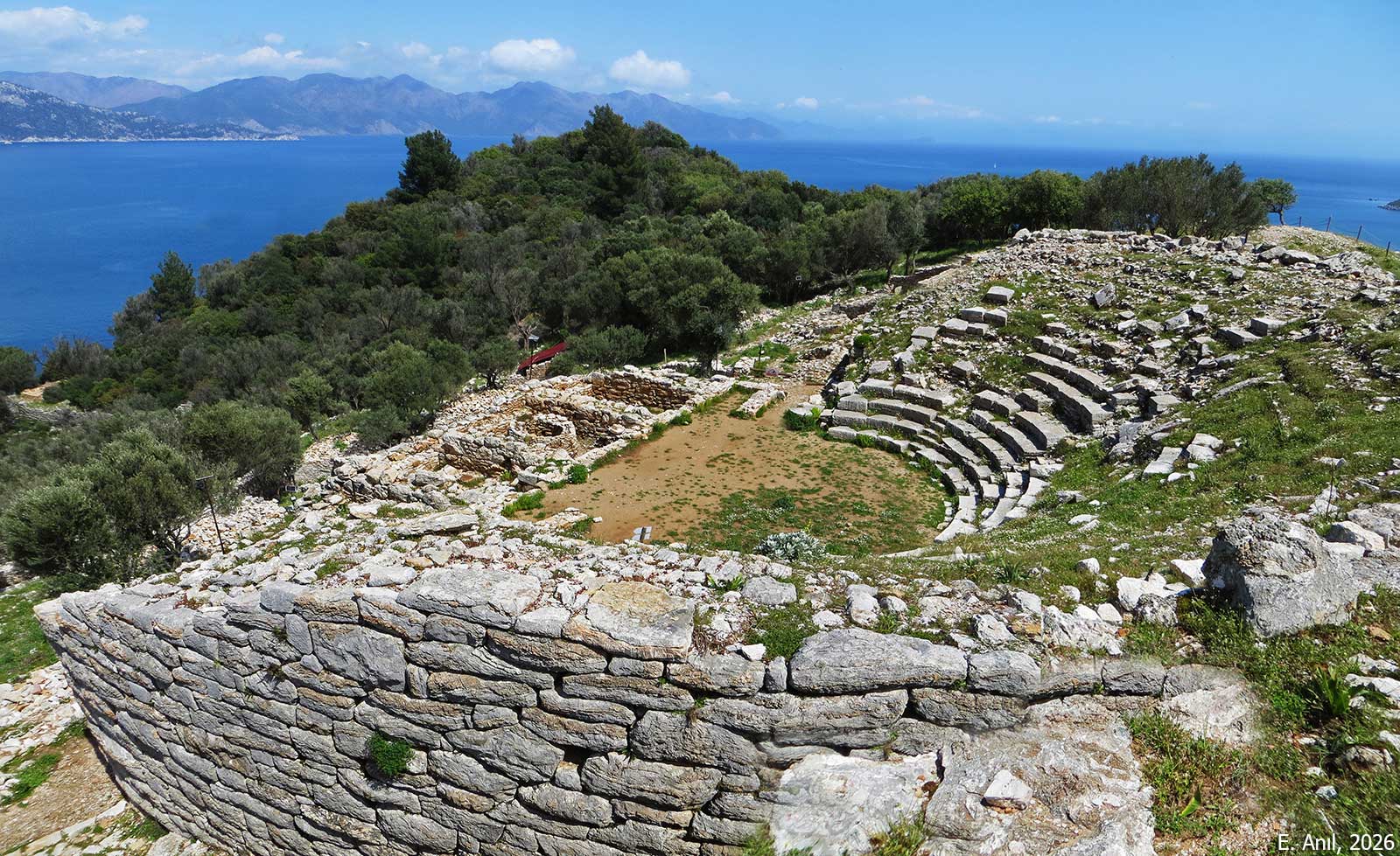
Amos is situated on the Asarcık Hill (also known as Hisarburnu), a headland approximately 20 km southwest of Marmaris (ancient Physcus) and 2 km south of the modern town of Turunç. The city occupies a strategic peninsula rising 102 meters above sea level, flanked by two natural harbors: the Amos/Asarcık Bay to the north and the Kumlubük Bay to the south.
Recent excavations have significantly revised the timeline of Amos, extending its date to the Sub-Mycenaean/Protogeometric period (approx. 10th century BCE). In the archaic/classical period, the city was active by the 6th century BCE. It appears in the Athenian Tribute Lists (428 BCE), paying a tribute of 2250 drachmae, indicating a level of economic prosperity. The most prosperous era of the city was the Hellenistic period. Amos was incorporated into the Rhodian Peraia (Rhodian mainland territory) likely as a deme of Lindos. The city utilized a system of leasing public/sacred lands, evidenced by lease contracts found on site. The settlement appears to have been abandoned or significantly declined after the 3rd century CE.
The site on Asarcık Hill was visited in the mid-19th century by R. Hoskyn, who misidentified it as “Samos” due to a scribal error in the ancient text Stadiasmus Maris Magni. This error was corrected in 1894 by M. Holleaux, who correctly identified the settlement as Amos. The first excavation was conducted in 1948 by G. E. Bean, who uncovered significant inscriptions, including lease contracts, though no further fieldwork took place for decades. Recent research and excavation works led by M. Gürbüzer in 2019.
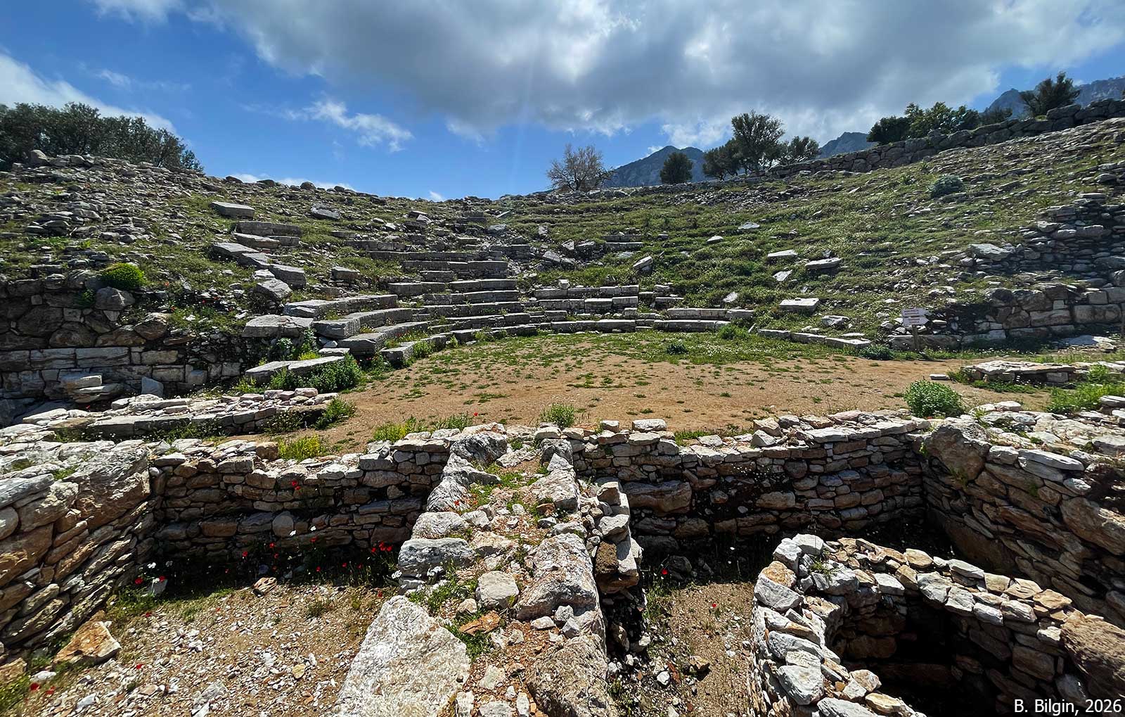
The theater with an estimated capacity of around 1,000–1,300 spectators is one of the most prominent surviving structures, though it shows signs of systematic dismantling in antiquity. The side retaining walls (analemma) are well preserved. The seating (cavea) area is largely ruined. While the lower rows are partially preserved, the majority of the high-quality rectangular seating blocks were dismantled and removed in the past, likely for reuse elsewhere. Excavations indicate the stage building was destroyed by a fire in the 3rd century CE, only the foundations are preserved.
The settlement is organized into three main terraces: the upper terrace (acropolis), the middle terrace (sanctuary of Apollo), and the lower terrace.
The temple is located on the western tip of the acropolis and attributed to Athena based on the discovery of a semi-circular exedra and statue bases typical of Athena sanctuaries in the region (similar to Lindos). The structure is preserved only up to the platform. Excavations revealed that this Hellenistic temple was built directly over an Early Iron Age apsidal structure (10th century BCE). Another small temple is identified in the middle terrace, which is dedicated to the city’s chief deity, Apollo Samnaios. It is identified through a stele listing priests and temple inventory found in situ in 2020. Almost nothing is preserved other than some architectural fragments that suggest a hybrid architectural style mixing Doric and Ionic orders.
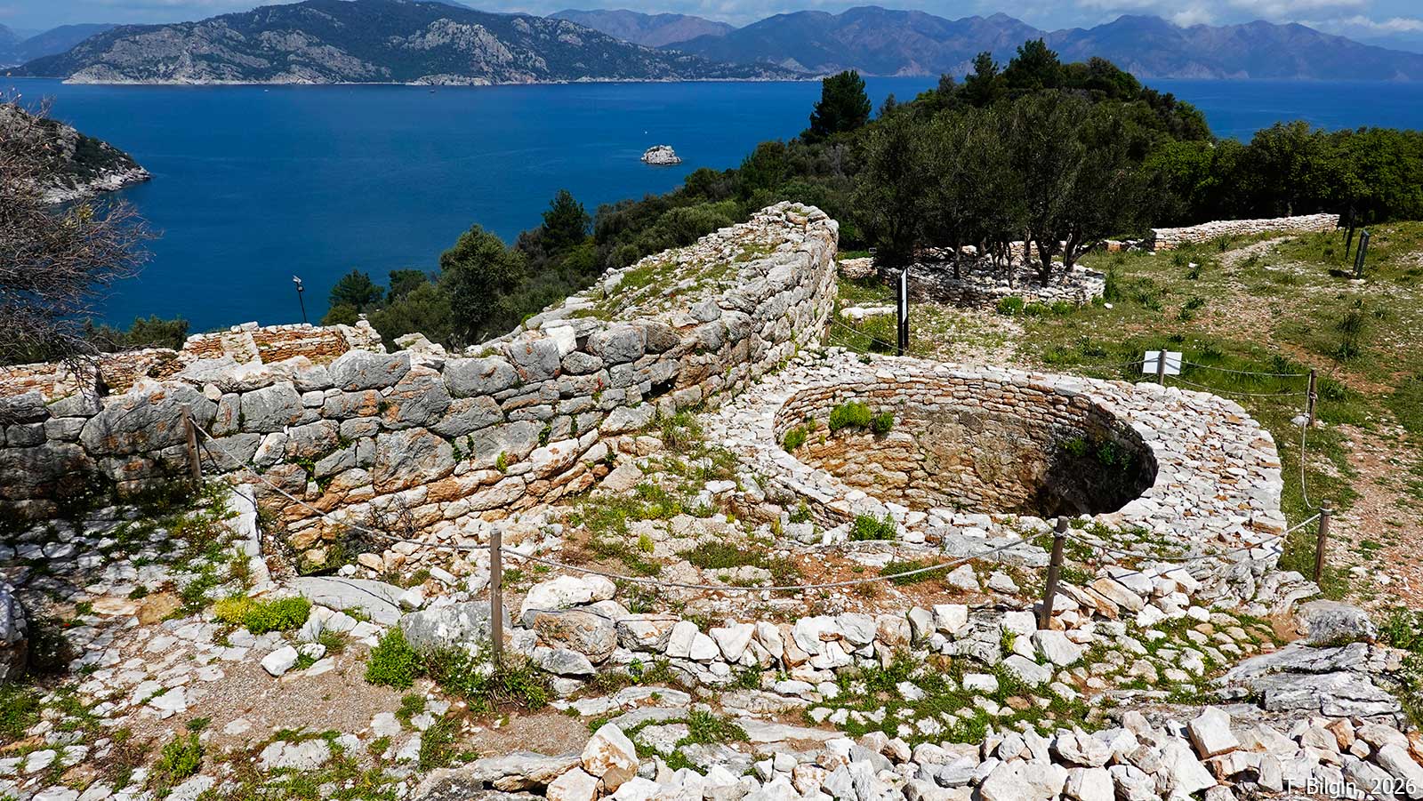
A comprehensive defensive system encloses the city, featuring walls constructed in both polygonal and rectangular masonry. The northern walls are well preserved, featuring towers (bastions) and even a surviving window opening. The necropolis extends across the slopes outside the city walls. It includes rock-cut tombs, sarcophagi, and distinct stepped podium tombs, a type characteristic of the Rhodian Peraia cultural sphere.





References:
Gürbüzer, M. 2021. “Amos’ta Yeni Araştırmalar ve Bulgular / New Research and Finds in Amos,” Cedrus IX, 219–249.
Gürbüzer, M. 2023. “Amos Kazısı 2020-2021 Yılları Kazı Çalışmaları,” KST 42/3, 405–424.
Gürbüzer, M. 2025. “Amos Antik Kenti: Karia Khersonesos’unun Lideri,” in Muğla Kazı ve Araştırmaları 1, ed. B. Söğüt, Ankara, 1–24.
Images:
M. Gürbüzer, 2021
Ertuğrul Anıl, 2026
Bora Bilgin, 2026
Tayfun Bilgin, 2026