Amyzon is located in the northwestern corner of Caria, situated at an altitude of approximately 667 meters in the Latmos mountain range (modern Beşparmak Dağları). The site is isolated and mountainous, functioning as a bastion that naturally restricts circulation. It overlooks the plain of the Maeander River to the north and the Marsyas (Çine) River valley to the east. The ancient name has persisted in the local toponym Mazın (or Mazınkale).
While Amyzon was a relatively small city compared to major centers like Alabanda, it provides significant evidence regarding the political and religious history of the region. The monumentalization of the sanctuary occurred under the Hecatomnid dynasty. An architrave block found at the site bears a dedication by Idrieus, son of Hecatomnus (ruled 351–344 BCE). In the Hellenistic period, Amyzon was under control of Ptolemaic and Seleucid kingdoms. By the second half of the 2nd century BCE, Amyzon entered into an agreement (sympoliteia or alliance) with its neighbor Heracleia. During the Roman era, Amyzon appears to have functioned primarily as a site of religious significance rather than a major political power. In the Byzantine era, the site changed character drastically, shifting from an open sanctuary to a fortified position known as a castro. The ancient Hellenistic buildings dismantled to build the new defensive walls and towers in this period.
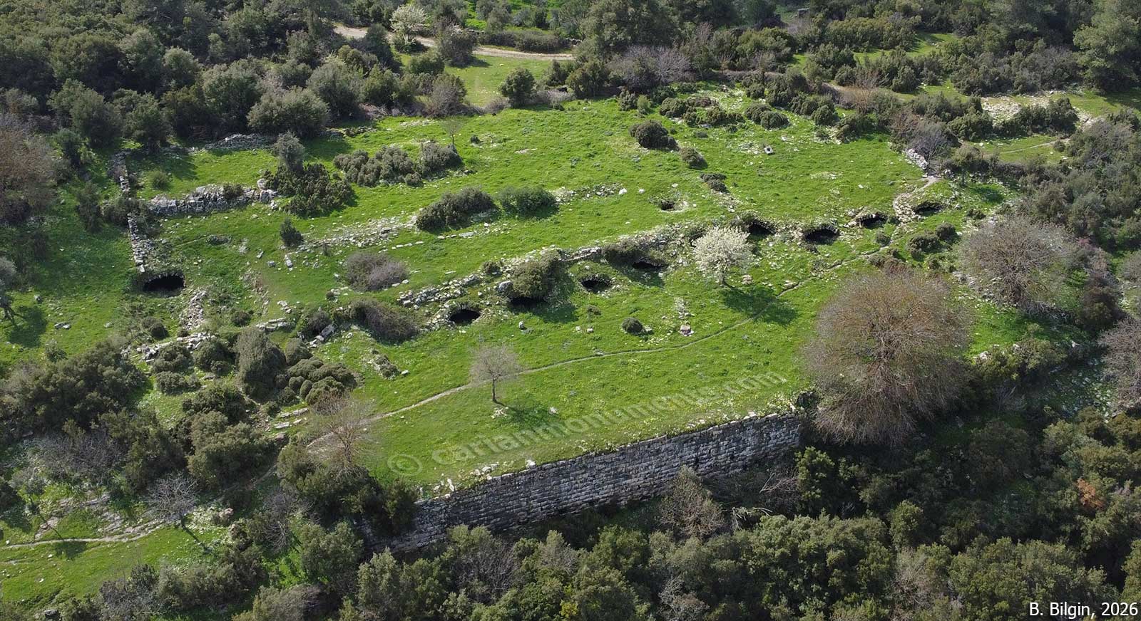
The focal point of the city was the Temple of Artemis, built on a leveled terrace on the summit. The sanctuary complex was an example of the Ionian Renaissance, displaying high-quality workmanship similar to Hecatomnid projects at Labraunda. The temple stood on a massive terrace supported by isodomic masonry walls, extending approximately 220 meters. According to Louis Robert, it was a Doric structure, though recent assessments note Ionian technical features. The naos (inner chamber) measured approximately 7.50 x 7.00 meters. The deity of the sanctuary was likely an indigenous nature goddess assimilated into Artemis.
The barrel vaulted corridors on the long terrace are thought to be used as storage areas or cisterns. Because these corridors are systematically aligned and include some marble elements, it is believed that they may have also functioned as the foundational infrastructure for a larger architectural unit.
The city was identified as early as 1824 by W. Leake but remained largely unexamined until the extensive excavations led by L. Robert in 1949. Today, the ruins are completely covered by forest and shrubbery. The city walls are the most significant and visible structures. The Temple of Artemis, most important structure in the city, is survived only at the base level.




References:
Hellström, P. 2009. “Sacred architecture and Karian identity,” in Die Karer und die Anderen: Internationales Kolloquium an der Freien Universität Berlin 2005, ed. F. Rumscheid, Bonn, 267–290.
Pedersen, P. 2020. “The Ionian Renaissance in the Architecture of Western Asia Minor” in The Carians, From Seafarers to City Builders, eds. O. J. Henry & A. Belgin-Henry, İstanbul, 220–239.
Robert, L. 1953. “Le sanctuaire d’Artémis à Amyzon,” Comptes rendus des séances de l’Académie des Inscriptions et Belles-Lettres 97/4, 403–415.
Robert, L. & J. Robert. 1981. Fouilles d’Amyzon en Carie I, Paris.
Özkaya, V. & O. San. 2002. “Alinda and Amyzon: Two Ancient Cities in Caria,” AST 19/1, 237-254.
Images:
P. Hellström, 2009
Bora Bilgin, 2026
Tayfun Bilgin, 2026