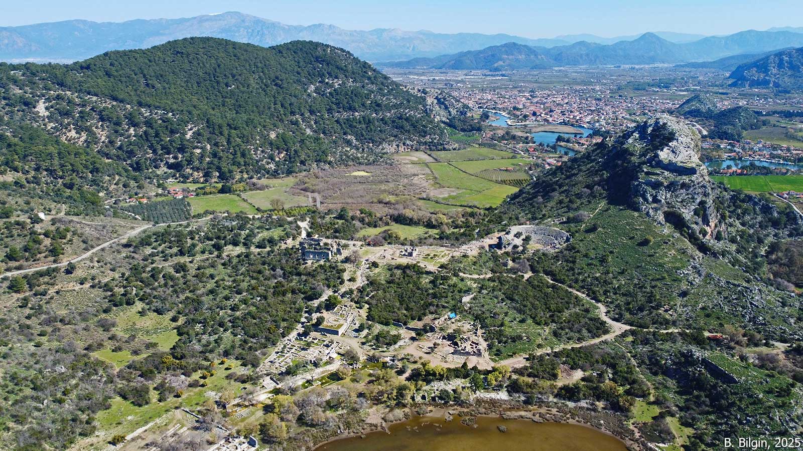
The ancient city of Kaunos (Caunus) is situated near the Çandır village of Köyceğiz. Geographically, it lies on the western bank of the Dalyan River (Calbis), which connects Lake Köyceğiz to the Mediterranean Sea. The city was a border settlement between the ancient regions of Caria and Lycia. While the Dalyan River acts as a natural boundary separating these two regions, Kaunos is historically considered a Carian city, though its territory extended into areas often contested or influenced by Lycia. The city’s topography is defined by the “Acropolis” and the “Little Acropolis” hills, extending over a terraced depression that once opened directly to the sea as a tongue-shaped peninsula. Due to the silting of the Dalyan Delta, the city is now located approximately 3 km inland.
The city is known by two names: The Hellenic Kaunos and the indigenous Carian Kbid. The name Kbid—appearing on coinage and inscriptions—is philologically linked to the Carian/Luwian roots for “water” or “river,” reflecting the city’s hydraulic geography. According to Herodotus, the Caunians claimed descent from Crete, but the historian assessed them as indigenous Anatolians based on their unique language and customs. This assessment is supported by the discovery of the Carian and Greek Bilingual Stele at the site, which has been instrumental towards the deciphering the Carian language. The city’s religious life centered on the “Basileus Kaunios” (King Kaunos), a deity often represented by a sacred stone (Baitylos) rather than a figural statue, underscoring a local Anatolian cult tradition distinct from the standard Hellenic pantheon.
After the Persian conquest in 6th century, Kaunos oscillated between Persian control and membership in the Delian League (Athens) during the 5th century BCE. Under the Hecatomnid dynasty (4th century BCE), particularly under Mausolus, the city flourished as a political and religious center, heavily Hellenized in its architectural appearance. After Alexander the Great, Kaunos was contested by the Diadochi, falling under the influence of the Ptolemies, Seleucids, and Rhodes at various times. It was incorporated into the Rhodian Peraea but maintained periods of independence.
Under the Roman rule, Kaunos was part of province of Asia and later attached to Lycia-Pamphylia by the 1st century CE. In the Christian era, Kaunos was a bishopric seat. The site was gradually abandoned following the Arab raids (7th century CE) and malaria outbreaks, becoming a village.
The site was identified as Kaunos by the British naval officer Rd. Hoskyn in 1840, who found an inscription referencing the “People of Kaunos.” Systematic excavations began in 1966 and continue to day.
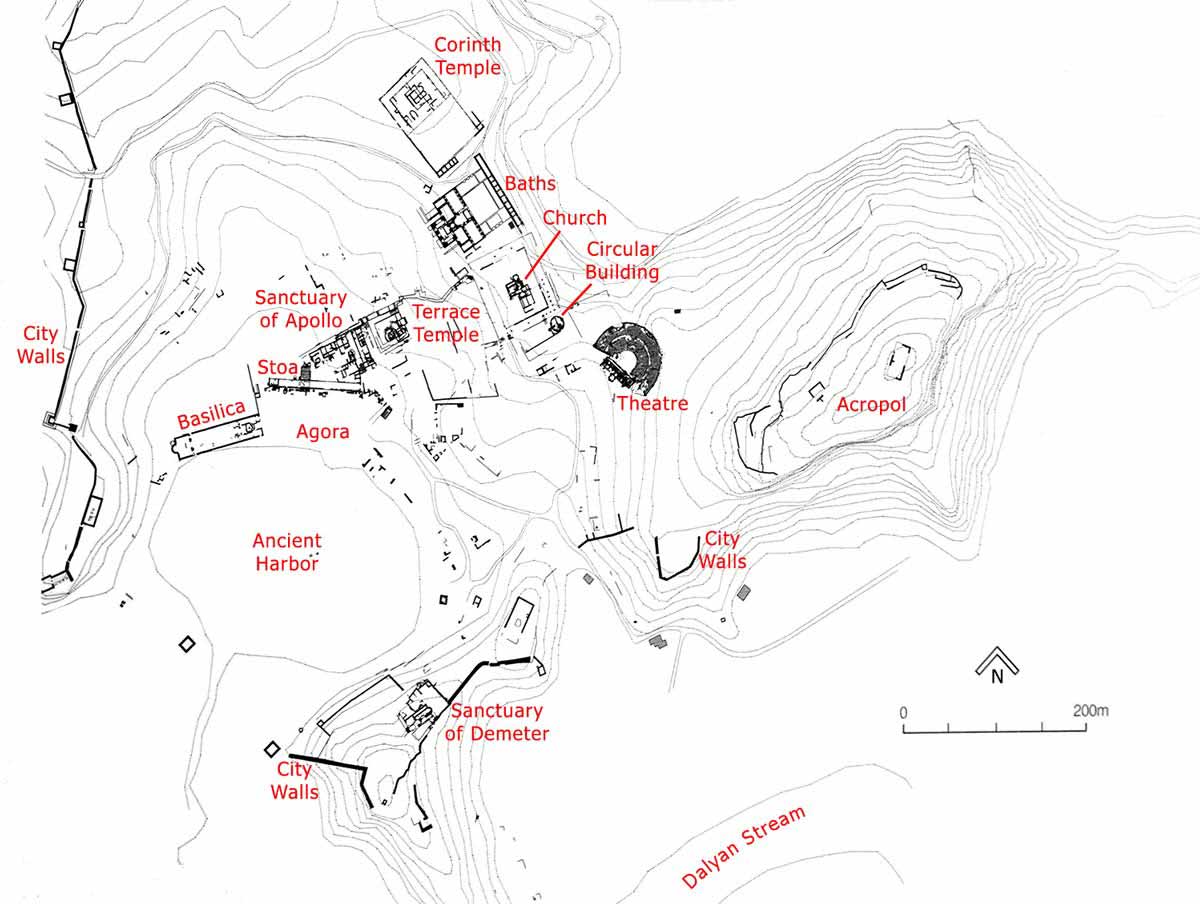
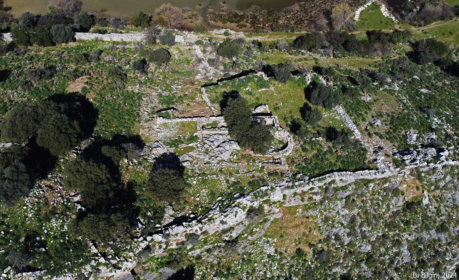
The fortified upper citadel (acropolis) contains remains of a cult area for Basileus Kaunios. The Little Acropolis features a sanctuary dedicated to Demeter, used for the Thesmophoria festival.
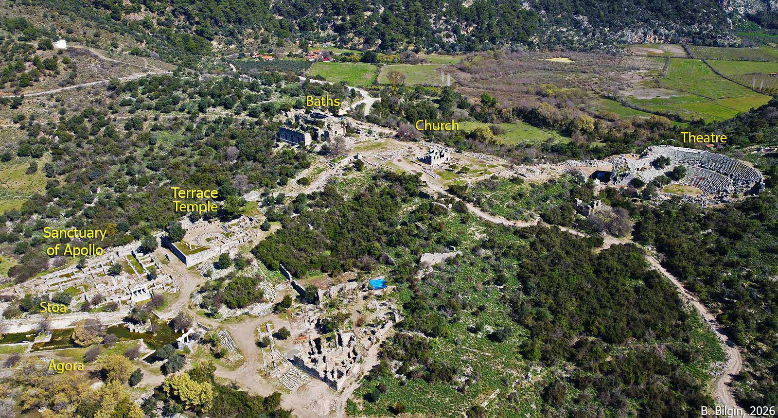
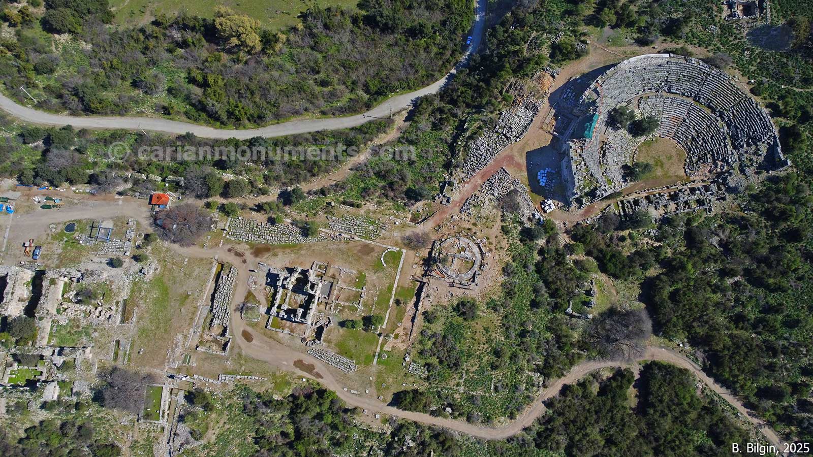
A Hellenistic theater has a capacity of 5,000. Uniquely, it preserves evidence of a Periaktos—a revolving triangular prism device used for changing scenery, a mechanism described by Vitruvius but rarely found archaeologically.
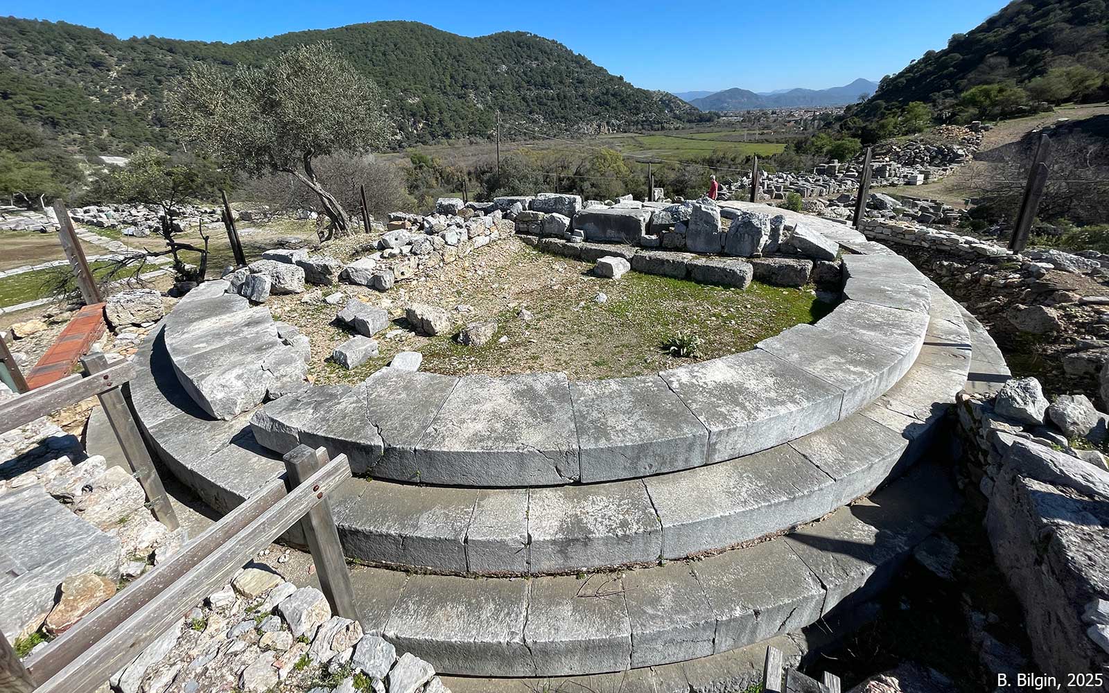
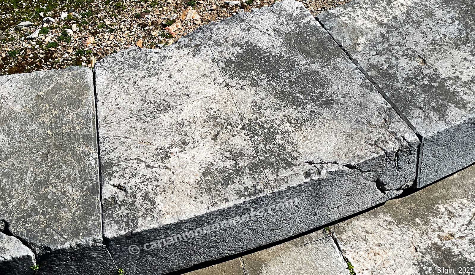
A circular structure (dated c. 150 BCE) with a precise geometric grid engraved on its surface was originally thought to be a wind-measuring device for urban planning, but it is now also interpreted as an astronomical observation platform or “Astrolabe.”
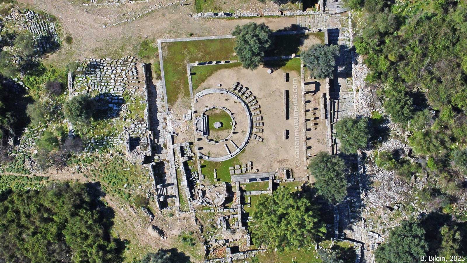
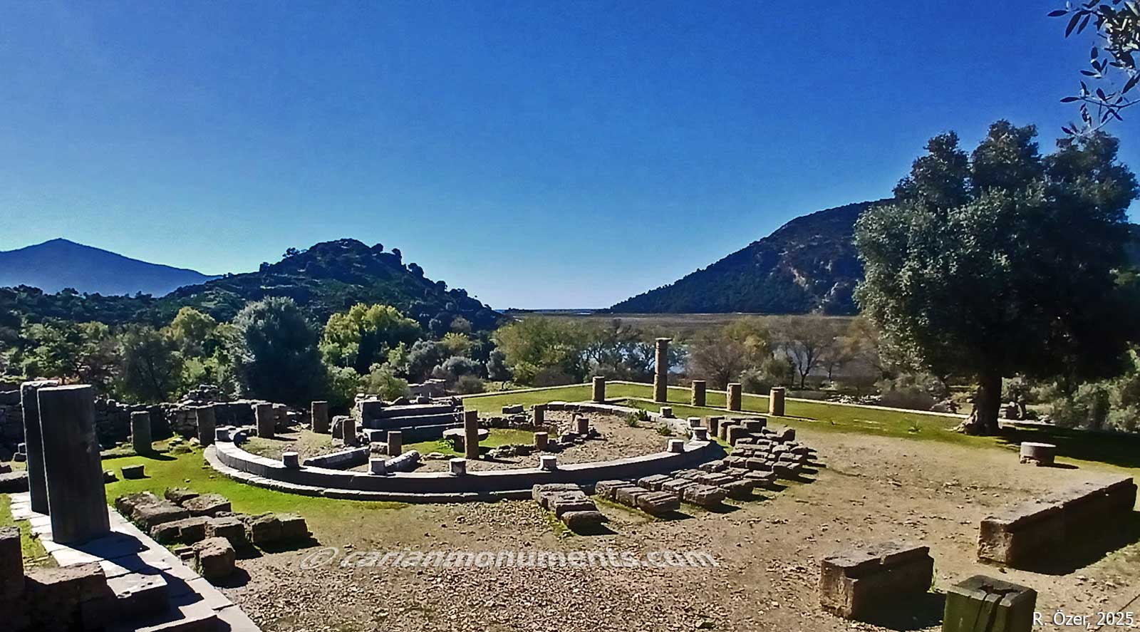
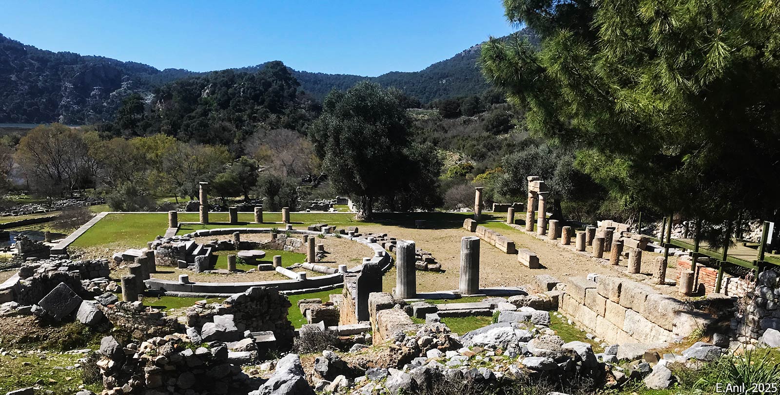
The religious architecture of Kaunos is characterized by monumental sanctuaries situated on terraces, such as the Temple of Zeus Soteros, which houses the sacred Baitylos stone of the indigenous King-God Basileus Kaunios, and the rock-cut precinct of Artemis Eleuthera within the Apollo Sanctuary. The city also features specialized cult centers like the sanctuary of Aphrodite Euploia inside the Stoa for mariners and the terrace of Demeter on the Little Acropolis used for fertility festivals. This pagan heritage eventually gave way to Christianity, represented by significant structures like the well-preserved 6th-century Domed Church located on the palaestra terrace
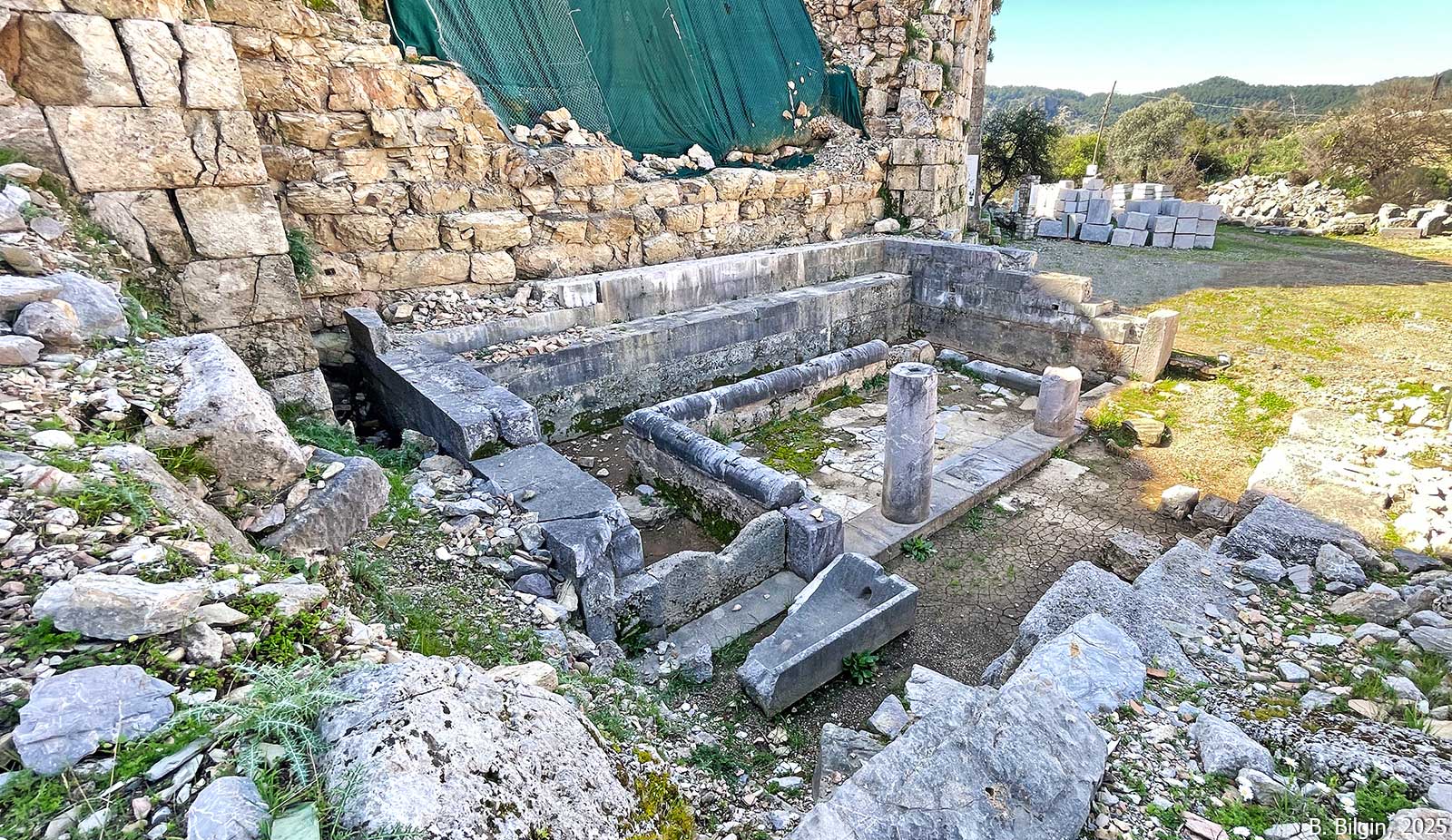
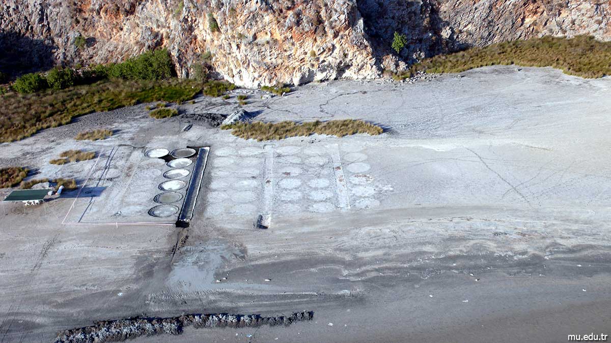
The commercial center (agora) features a long stoa containing the Sanctuary of Aphrodite Euploia. An agora fountain bearing a lengthy inscription detailing the new customs regulations and tax exemptions granted to revive the city’s economy in the Roman period. The salt pan that is located on İztuzu beach, was used for producing the famous “Kaunos Salt,” a medicinal and culinary export.







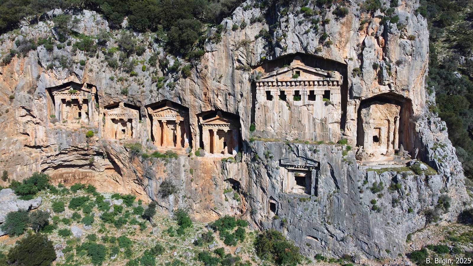
Kaunos Rock-Cut Tombs
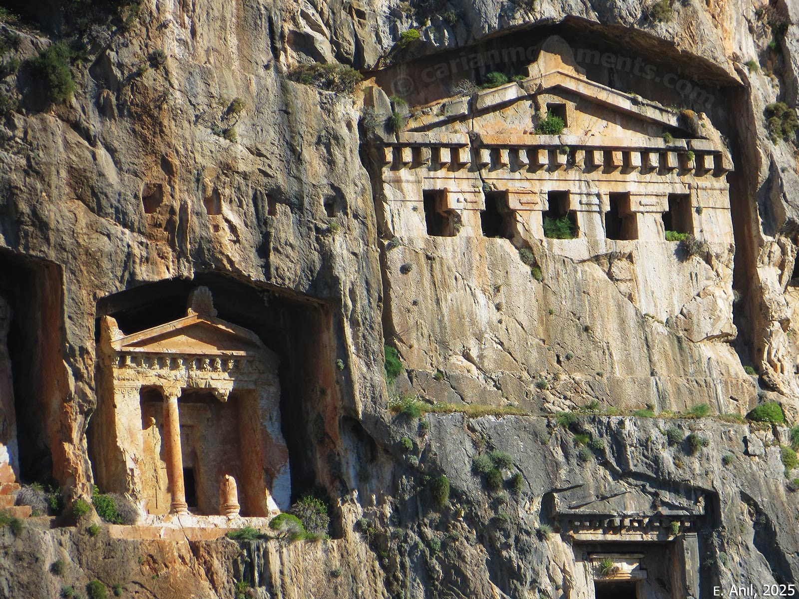
The monumental rock-cut tombs of Kaunos are carved into the steep limestone cliffs facing the Dalyan River and the ancient coastline during the 4th century BCE. While there are approximately 150 rock-cut tombs scattered across the site, the most significant are the fifteen “temple-faced” rock-cut tombs with Ionic columns in antis, pediments, and friezes.
The most famous assemblage is a group of six monumental tombs, which includes a massive, unfinished tomb that reveals the ancient methods of carving from the top down. Additionally, the cliffs are honeycombed with smaller, rectangular niches known as “pigeon’s nests”, which were used for urns or less elaborate burials.



References:
Çörtük, U. 2024. “Cumhuriyetimizin 100. Yılında Kaunos-Kbid Kazıları,” in Cumhuriyet’in 100. Yılında Dünden Bugüne Muğla I, eds. A. Karaca & G. Mammadova, Muğla, 104–134.
Işık, C. 2020. “Geride Bırakılan 50 Yılın Arkeolojiye Kazandırdığı İlkleri ile Kaunos.” in The Carians, From Seafarers to City Builders, eds. O. J. Henry & A. Belgin-Henry, İstanbul, 422–445.
Roos, P. 2020. “Karia’nın Kayaya Oyulmuş Tapınak-Mezarları,” in The Carians, From Seafarers to City Builders, eds. O. J. Henry & A. Belgin-Henry, İstanbul, 284–295.
Öğün, B. et al. 2002, Kaunos. Kbid. 35 Yılın Araştırma Sonuçları (1966-2001), İzmir.
Images:
Muğla Sıtkı Koçman Üniversitesi Arkeoloji Bölümü, 2015
Ertuğrul Anıl, 2025
Bora Bilgin, 2025
Tayfun Bilgin, 2025
Reha Özer, 2025